An Easy One Day Death Valley National Park Itinerary
This one day Death Valley National Park Itinerary was absolutely perfect for us.
The best time to visit Death Valley is in the winter months. We visited in November 2023. The weather was cool. The crowds were pretty thin. The main parts of the park were open (after some heavy flooding in August 2023).
We had low expectations, to be honest. It’s one of the reasons we only planned a day trip. But if we were doing it all over again, we’d definitely spend more time in Death Valley.
The only thing we really knew about Death Valley was that it was typically very hot. So visiting in November felt like a safe bet to get it checked off our list.
But we were blown away.
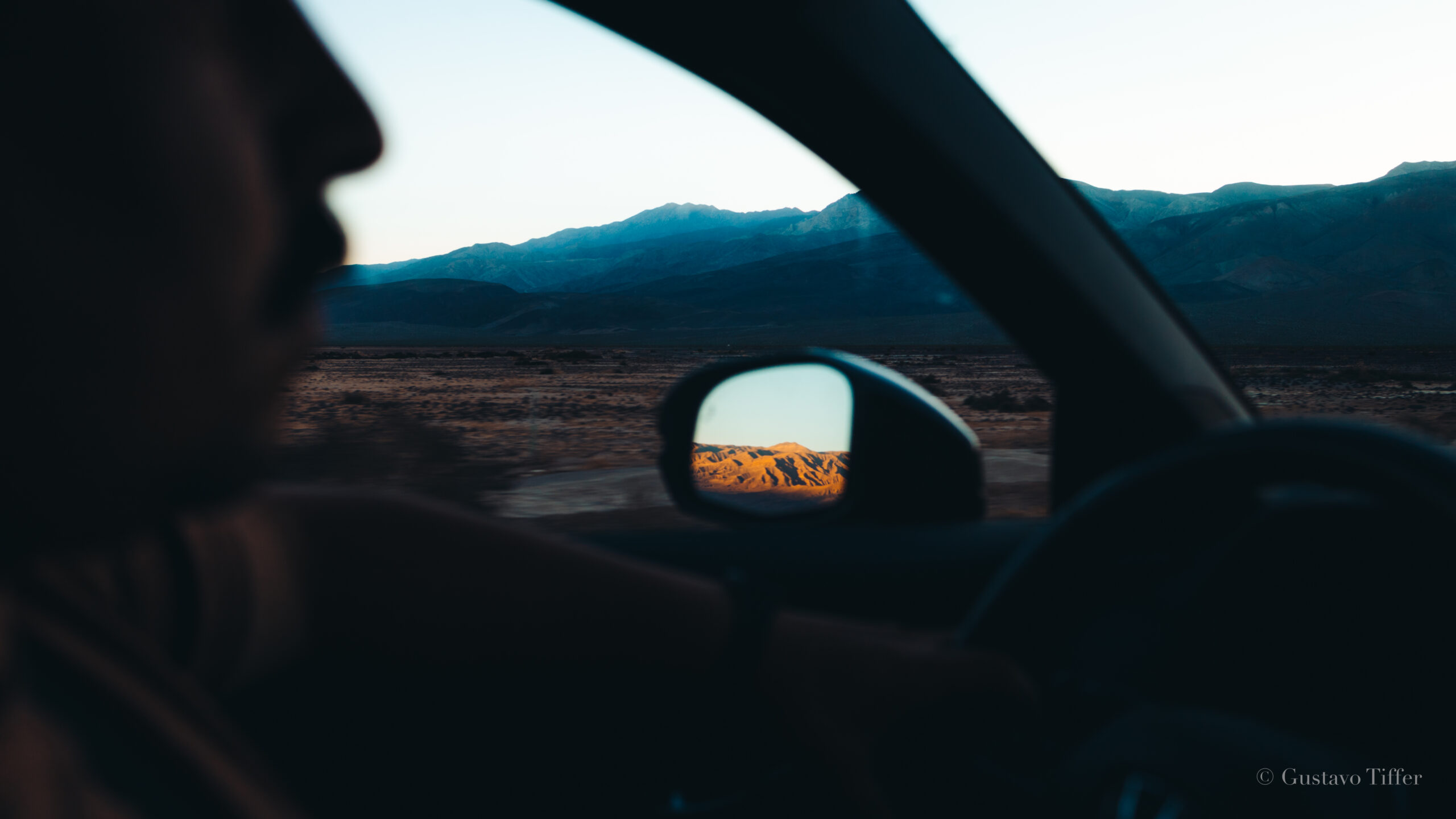
As we drove off into the sunset (literally), we looked at each other and said,
“Death Valley might be in our top 5 parks.”
Let us tell you why.
Enjoy this One Day Death Valley National Park Itinerary!
How to See Death Valley National Park in One Day
Death Valley is a relatively easy park to navigate for beginners. The trick is to simply get up early. We started our day at 4:30am and ended at 7pm. Oof.
Luckily, the most popular attractions are all in the heart of the park – near Furnace Creek and Badwater Basin. But even though the popular areas are bunched together, we still did lots of driving.
Death Valley contains 3.4 million acres of land, making it the largest park in the lower 48 states. The only larger parks are in Alaska. Hence the driving.

The main road cutting through DV is CA-190. It goes right through the heart of the park and connects California and Nevada.
There’s lots more things to do in Death Valley than can be found in this one day itinerary. We’ll definitely be back!
The last thing to note is this itinerary can be adjusted depending on where you’re staying.
- If you’re on the CA side, follow this in order.
- If you’re on the Nevada side, reverse it
Or do whatever makes you happy.
Let’s start your itinerary!
Sunrise: Mesquite Flat Sand Dunes

At the Mesquite Flat Sand Dunes, you will be met with the most mysterious sunrise you ever experienced.
The vast dunes turned from nearly white to golden as the light peaked over the surrounding mountains.
Mesquite Flat is located just past Stovepipe Wells Village. There is clear signage and a parking lot you can’t miss.
You can meander around the sand dunes. We couldn’t find a clear trail (and it didn’t seem like anyone else was on a trail, either!) There were folks way out in the distance and others just by the parking lot.

Take photos. Explore the variety of things you’ll see there – cracked earth, twigs, and of course the surrounding sand dunes.
Get up early and drive to the Mesquite Flat Sand Dunes for sunrise.
We stayed in nearby Trona, CA and it took us about 1.5 hours to get to Mesquite Flat. Plan accordingly.
Mid-Morning: Dantes View
Dantes View is one of my favorite viewpoints in any park we’ve visited.

Standing 5,475 feet above sea level, this peak showcases how wide, vast, and deep Death Valley is.
Directly below you is Badwater Basin, one of the lowest points on earth (more on that later!). And directly across are another set of mountains with a notable point called Telescope Peak.
We were blown away at Dantes View because it gave us incredible 360º views of the valley and the surrounding wilderness. I have never felt so small in such a big place.
The drive up to Dantes View is also very unique. Most of the road is a steady incline. But the last ¼ mile is a 15% grade switchback to the overlook.
Don’t worry – our little Honda handled the switchbacks perfectly well. But it was fun to feel like we were literally climbing up! It’s probably the closest to 4WD off-roading we’ll get (for now at least!)
At the overlook you can explore the paved area where there are some signs that give you interesting information about the view and the valley.
If you’re up for a little adventure, just south of the parking lot (to the left) is a hiking path. There are little hills that take you to additional overlooks. The hike out gave us some additional views and photo opportunities over the valley.

It should take you about 1 hour to get from Mesquite Flats to Dantes View.
You will pass through Furnace Creek Village where you can fuel up if you need to.
We thought this was a good second activity of the day because it’s the farthest you’ll drive from the main attractions. Additionally, since it was still pretty early, there was almost nobody up there with us.
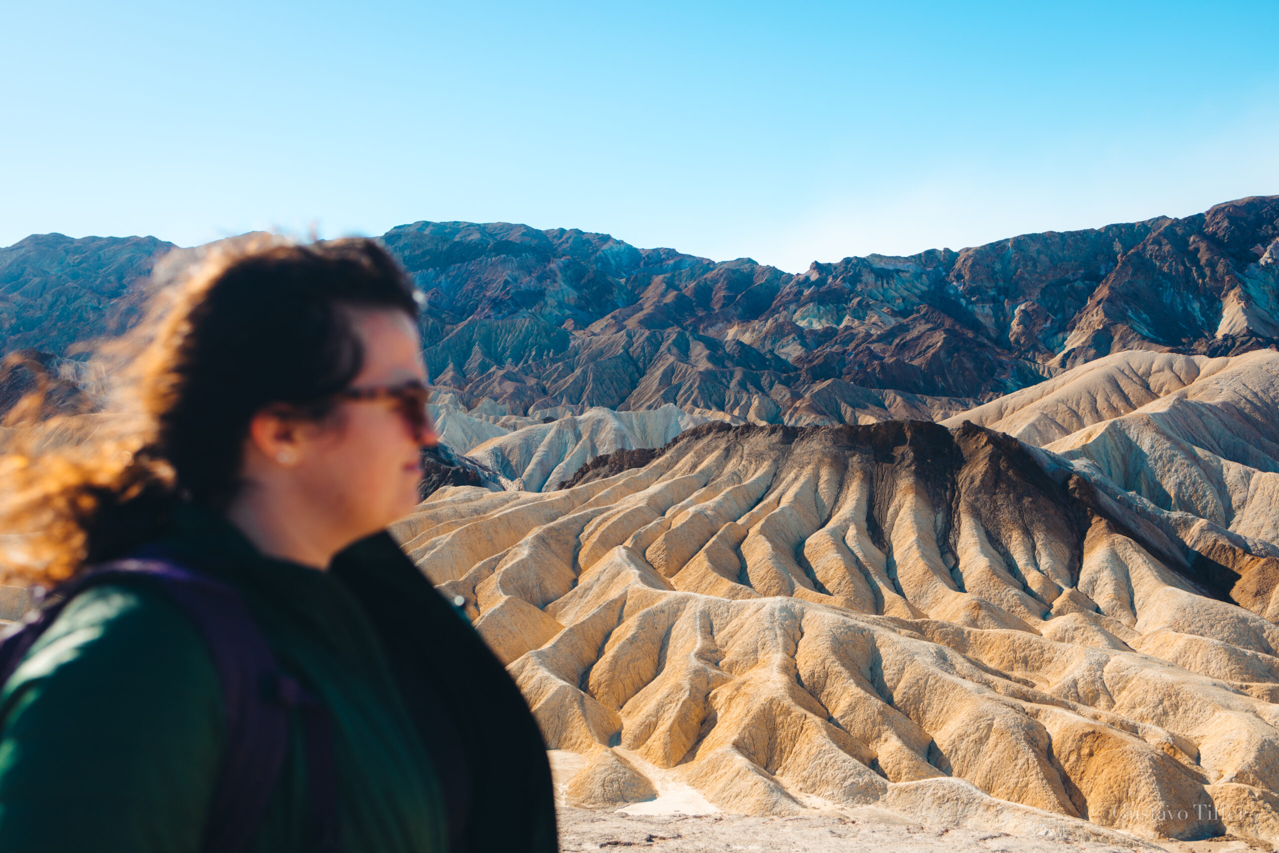
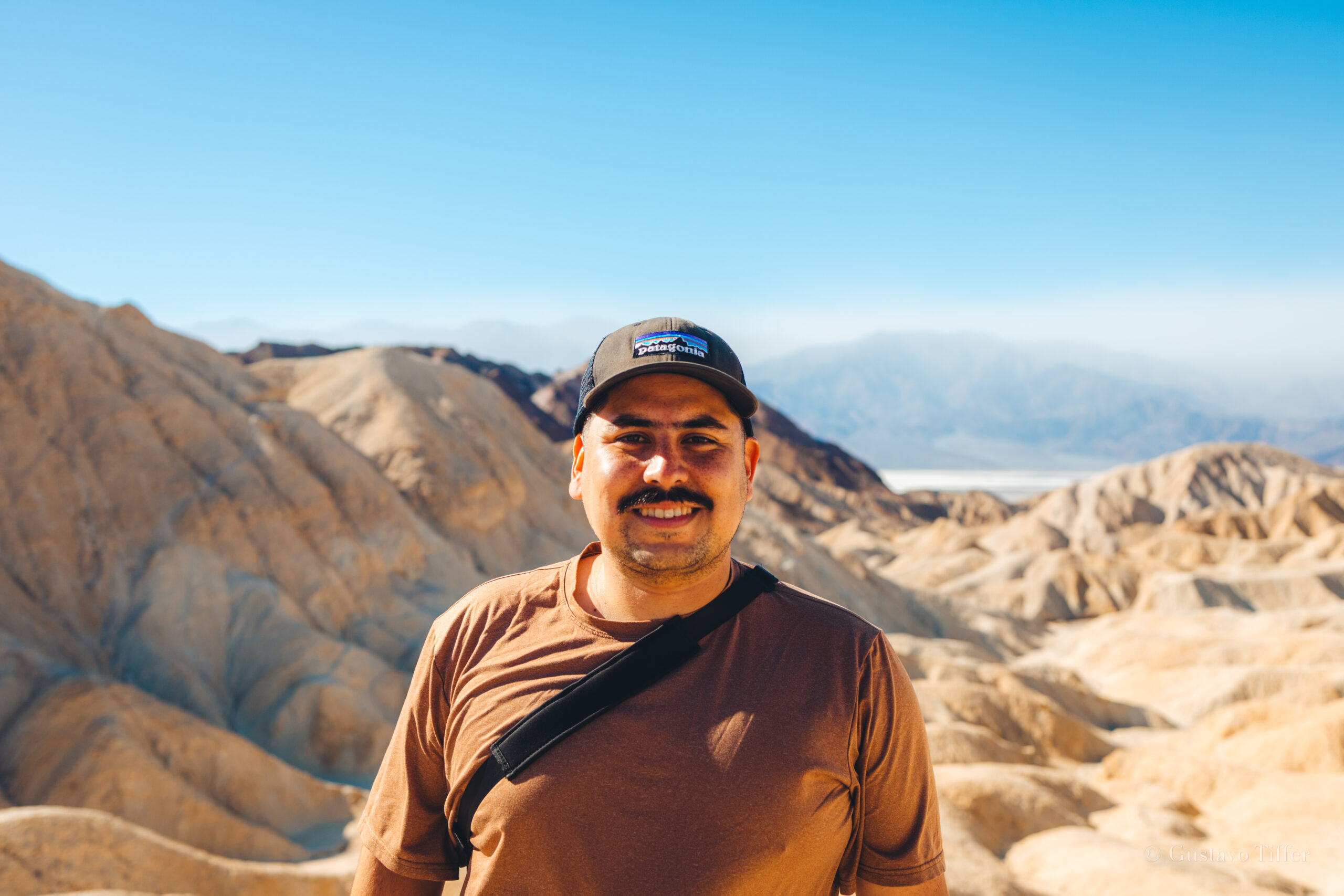
Mid-Day: Zabriskie Point & Badlands Loop
After hiking around Dantes View, drive 30 minutes back up to Zabriskie Point.
Zabriskie Point is another iconic view at Death Valley. It is located just north of Twenty Mule Team Canyon.
Zabriskie is lower in elevation compared to Dantes Peak, but you will still get incredible overlooks of the valley and the surrounding mountain range.
Even more interesting are the badlands around Zabriskie point. The soft, eroded rocks gave us incredible colors and a dramatic backdrop to some of our photos.
Once there, walk up the 100 yard (or so) incline to the official Zabriskie Point overlook. You will get a beautiful view of the surrounding badlands. I was taken aback by how glass-like the badlands looked. Even on a bright, sunny day, they looked smooth and glossy.
If you’re up for a hike, we recommend the Badlands Loop just off the Zabriskie Point parking lot. This 2.7 mile loop is easy-to-moderate and we finished it in about 2 hours.
The loop takes you into the badlands area and weaves in and out of different rock formations. This is a fairly popular trail, so you’ll likely encounter people along the way.
Be mindful of the heat during this hike, bring plenty of water, and definitely wear a hat. There is almost zero shade coverage so be sure to pause where you can and sip water. It’s easy to dehydrate on a hike like this!
This loop can connect you to the Golden Canyon and Gower Gulch trails, which take you to Badwater Basin (on the other side). We opted not to hike across, as it would have been 5+ miles. But definitely something to go back for!
Mid-Day Break: Furnace Creek Visitor Center
We often find that we start to crash in the middle of the day. We’re up early, hiking around, exploring, and we hit a wall.
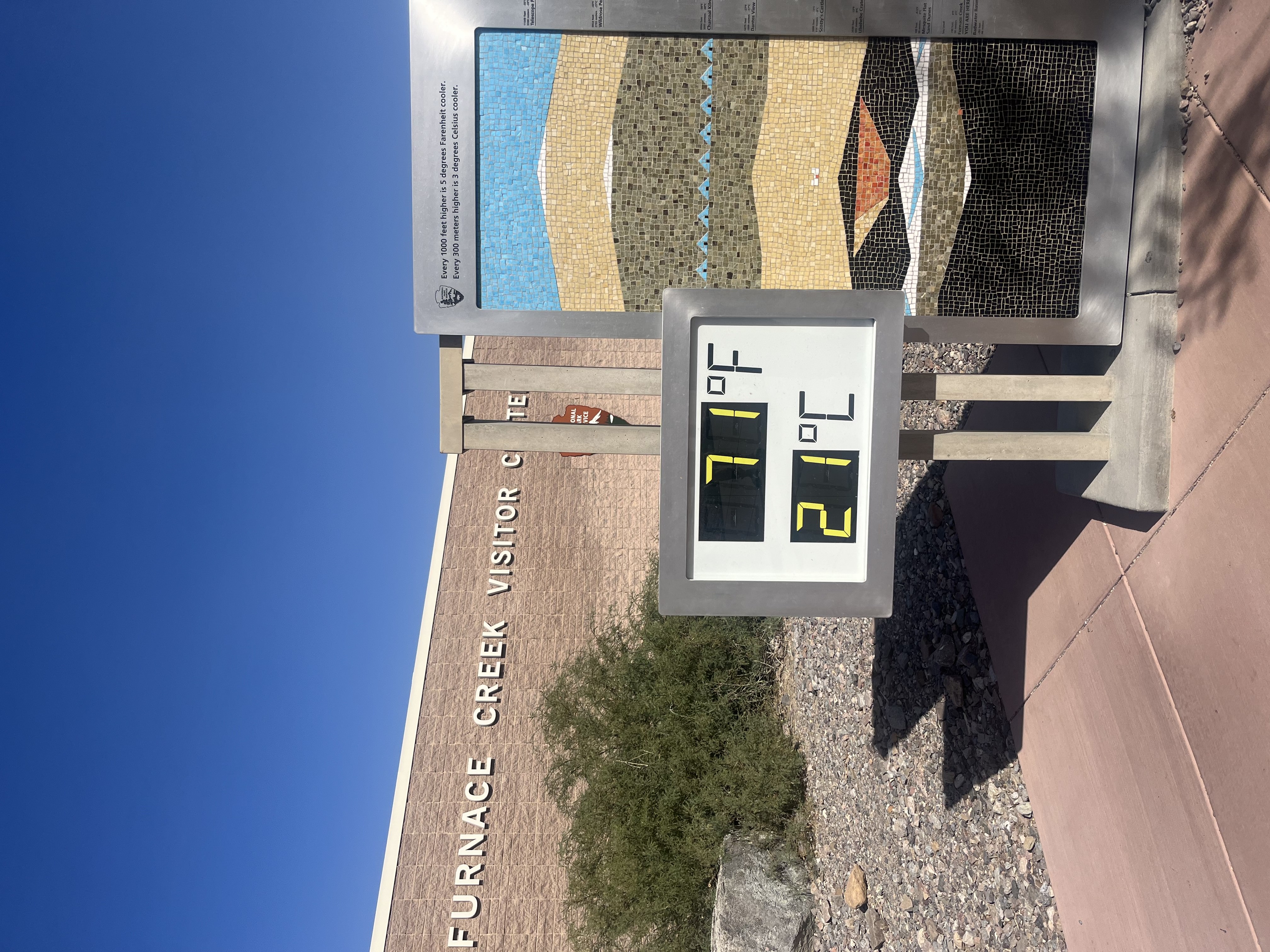
This is a great time to either find a place to nap or to stop by the Furnace Creek Visitor Center! Located at the very center of the park, visiting Furnace Creek gave us the opportunity to take a break, refill our water, buy our souvenirs, and reset.
We love chatting with the rangers at the visitor centers. They usually have great recommendations that we take into account for the rest of our trip!
For example, the ranger at Furnace Creek actually told us to avoid Natural Bridge as folks are prone to popping tires on that road. Note taken!
Grab water. Eat a snack. Go potty. And get ready for the rest of your day!
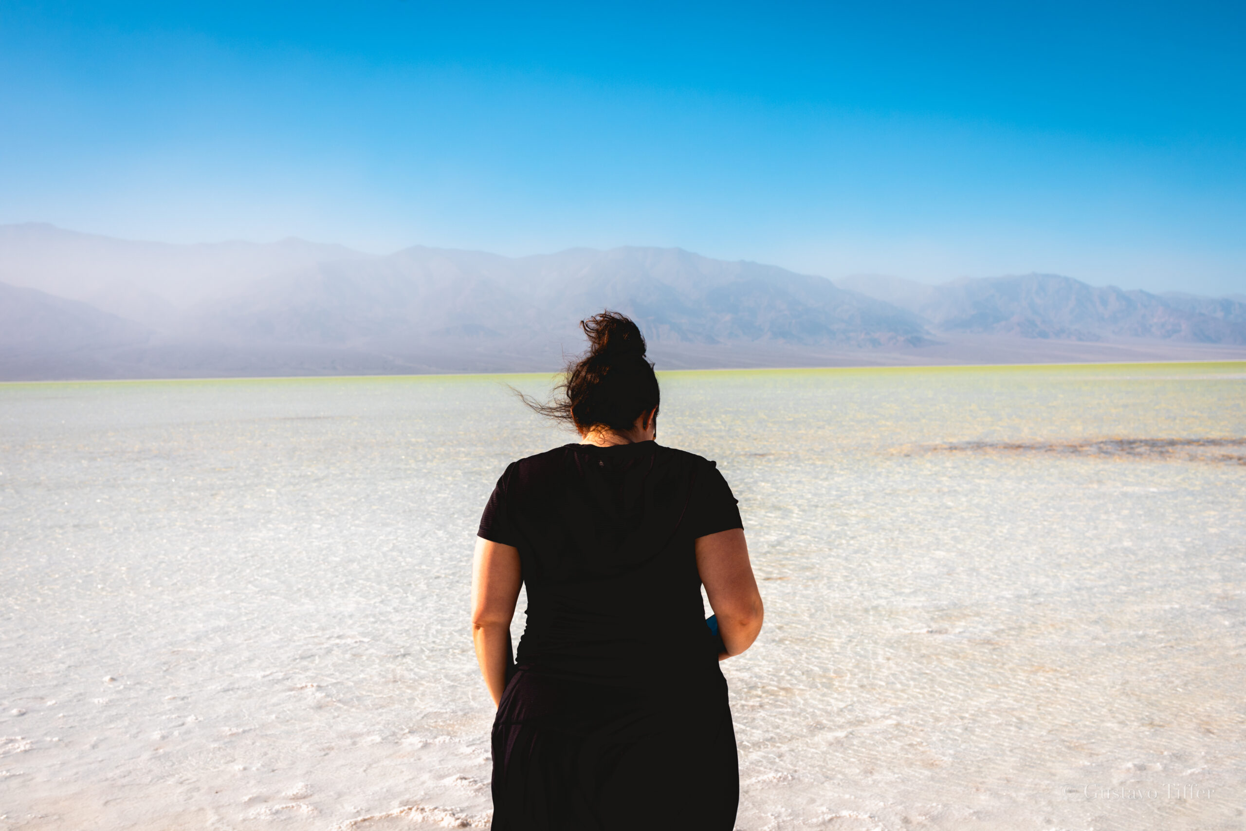
Late Afternoon Stop 1: Badwater Basin

The late afternoon is all about exploring stops along Badwater Basin road!
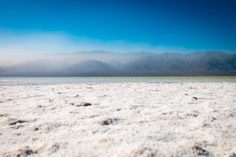
Badwater Basin is the lowest elevation in North America, sitting at 282 feet below sea level. This is the main attraction of this area.
The drive from Furnace Creek to Badwater Basin is about 18 miles and should take you just under 30 minutes.
Badwater Basin is an expansive salt flat in the very center of Death Valley. It is known for being bone dry. In fact, it is one of the driest places in the world. Many of the pictures you will find online are the square-like looking shapes.
But! We are lucky to share that we visited during a time when a rare lake had formed in Badwater Basin! In August of 2023, a storm dumped a year’s worth of rain onto Death Valley over the course of a few days. This transformed Badwater Basin from a dry salt flat to a small lake.

This meant we were able to walk out onto the salt flat and see/touch the water. It’s something that hasn’t been seen in Death Valley in over 20 years and we felt very lucky to have seen it. I even dipped my finger in the water and tasted it – very, very salty.
We explored the area for just under an hour. This is another place to make sure you have sunscreen and water. No shade coverage here.
Enjoy standing in the lowest elevation in North America – it was very cool!
Late Afternoon Stop 2: Artists Palette

After Badwater Basin, make your way back north to Artists Drive and Artists Palette.
The Artists Drive is a scenic, 9-mile road that twists and turns into the mountainside. What it honestly felt like was driving through Radiator Springs from the movie Cars. Probably a strange comparison, but the rocks, hills, and colors reminded me very much of that movie!
The highlight of this drive is a stop at Artists Palette. This area is famous for a colorful set of rocks – blues and greens and reds.
There is a very short hike taking you into the Artists Palette area. From here you can get up close to the colors, take photos, and enjoy the relatively easy hike.
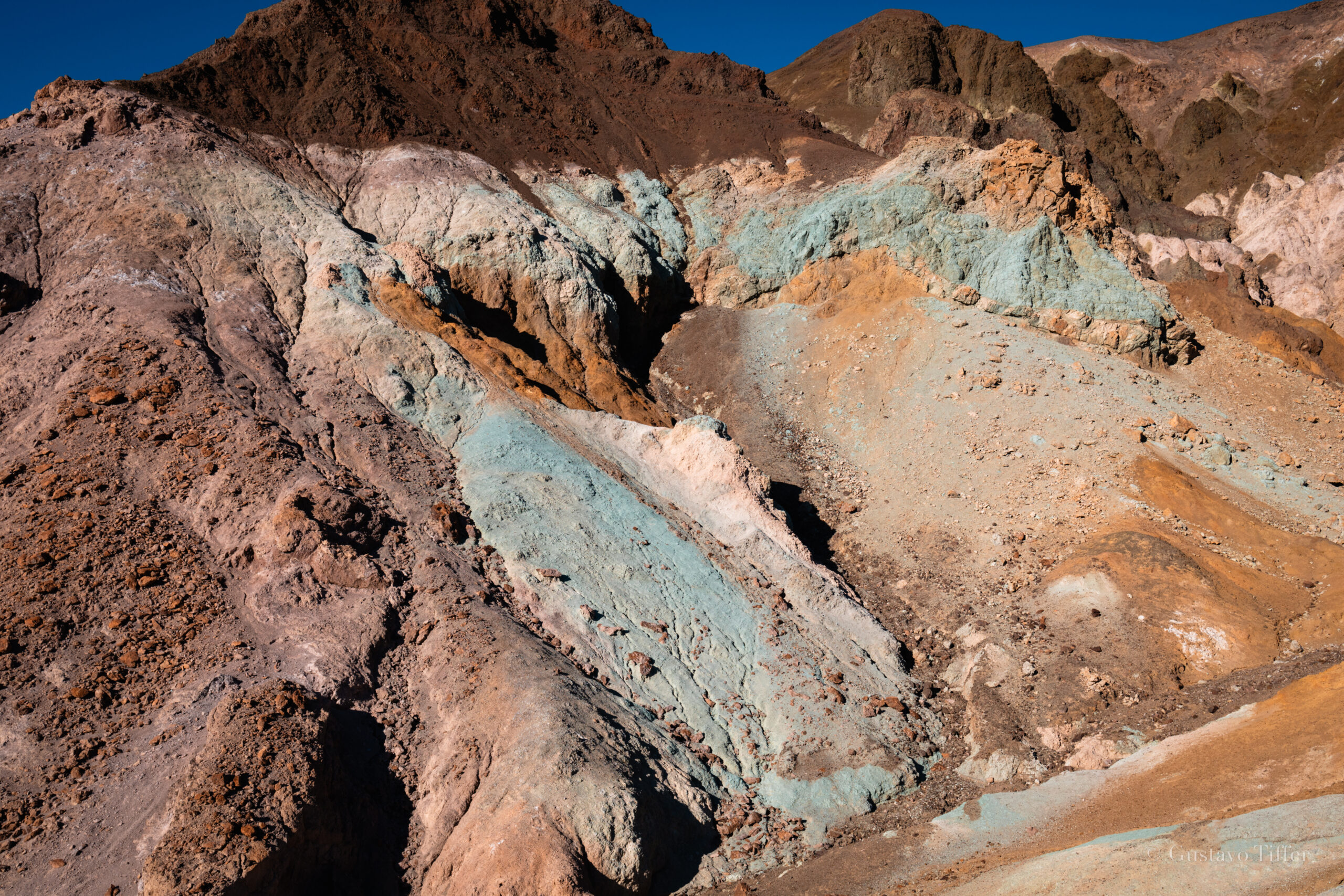
In hindsight, we think this would be a great spot for sunrise or sunset. The colors seem like they would really pop in the soft light of the morning and evening – next time!
There are a two other stops along Badwater Basin that are worth mentioning here:
- Devil’s Golf Course – an area of jagged rocks and spikes caused by erosion.
- Natural Bridge – a ranger told us to avoid this area due to frequent tire damage. But this short hike takes you to a bridge tucked into Death Valley canyon. Relatively easy hike.
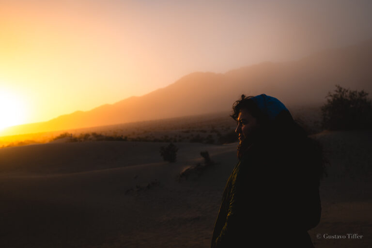
Night: Sunset and Stargazing (if you can swing it!)

Alrighty, you’ve almost made it through the day!
At this point you will probably feel very exhausted. If you’re lucky to spend more than one day in Death Valley, you’ll likely want to break up the itinerary above, but if you’re there for one day (like us), the end is in sight!
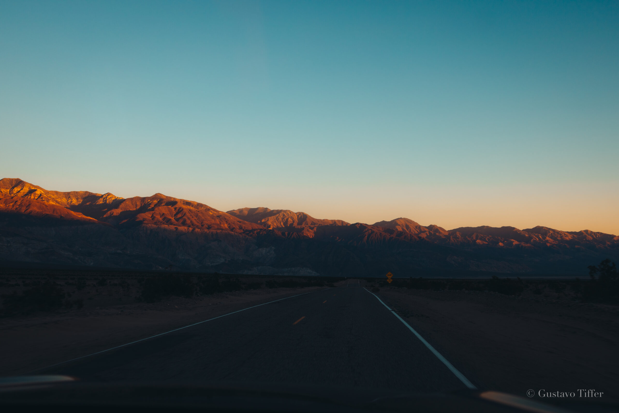
The sunset in Death Valley is seared into my memory. You can enjoy it from nearly anywhere in the park. We were driving through most of it and the mountains turned from orange to purple to blue. The hues were explosive and spectacular. A good spot to watch the sunset would probably be up at Dantes View (if you wanted to drive back up there!)
Lastly, Death Valley is known for its spectacular night sky. It is an international dark sky park – one of the few places in the world to receive this distinction.

Some other best places to view the night sky at Death Valley are at the Mesquite Flat and Badwater Basin, as those areas are wide open and provide clear views of the sky!
There are national park service ranger-led programs that introduce beginners to the night sky. We were unable to explore, but you can learn more about them here.
Get to Death Valley: Where to Stay
Death Valley is located right on the border of California and Nevada – with a majority of the park sitting on the CA side.
The best place to stay in Death Valley is a camping spot inside the park. We didn’t choose this option simply because we were only going to be there one night. In hindsight, it might have made it easier to get around the park in the morning.
On the CA side, the “biggest” nearby cities are:
- Olancha – 72 miles
- Ridgecrest – 69 miles
- Trona (also called Searles Valley) – 47 miles
- Panamint Springs – 3 miles
On the NV side, the best options are:
- Las Vegas – 126 miles
- Pahrump – 48 miles
- Amargosa Valley – 38 miles
- Beatty – 9 miles
We stayed at this Airbnb in Trona. It was a perfectly fine experience and gave us easy access to the park from the CA side.
For the closest stay, find some accommodations in Panamint Springs. Based on my research, the only place that had accommodations was the Panamint Springs Resort. Check it out.
Los Angeles to Death Valley
We started our trip from Los Angeles.
Our google maps took us up through Santa Clarita, Mojave, bypassing Ridgecrest, and finally up to Trona.
We drove for about 3.5 hours (factoring in stops for food/gas) to get to Trona.
From Trona, we took Trona Wildrose Road up to Panamint Valley Road to finally get into the park. From Trona to the park entrance was another hour.
So in all, from Los Angeles to the Panamint Springs entrance was 4.5-5 hours.
Las Vegas to Death Valley
The two most common cities you’re likely coming from are Las Vegas itself or Pahrump, NV.
From Las Vegas to Death Valley is between 111-126 miles. The best route takes you through Pahrump and into the Death Valley junction. This will bring you right into the heart of the park on CA-190.
From Pahrump you can take a similar route into DV junction and onto CA-190.
Make Your Own Death Valley Itinerary

Ultimately, we hope this post jumpstarts your plans for visiting death valley!
We don’t know your hopes or goals, but I imagine you found yourself here because you are very close to securing that trip to Death Valley.
It’s one of the most beautiful parks we’ve ever visited and it is now firmly in our top 5.
We especially loved it because it was so unexpectedly awesome. In California, you hear about visiting Yosemite or the Redwoods or Joshua Tree. DV is usually just known for being hot.
But we learned that Death Valley is more than that – mountains peaks, grand vistas, salt flats, sand dunes, and the lowest elevation on earth.
We loved making this Death Valley National Park Itinerary and hope you get out there soon!